Standort
Leeuwarden, NL
Nutzung
gemischt (Städtebau & Architektur)
Bauphase
Wettbewerb Europan 11, 2011
Entwurf
Evelyn Galsdorf (030ARCHITECTEN)
Anja Dirks (Inzight Architecture)
Chris van Gent (Bureau 5F10)
Beschreibung
NOMINIERUNG Europan 11
DESIGN ASSIGNEMENT
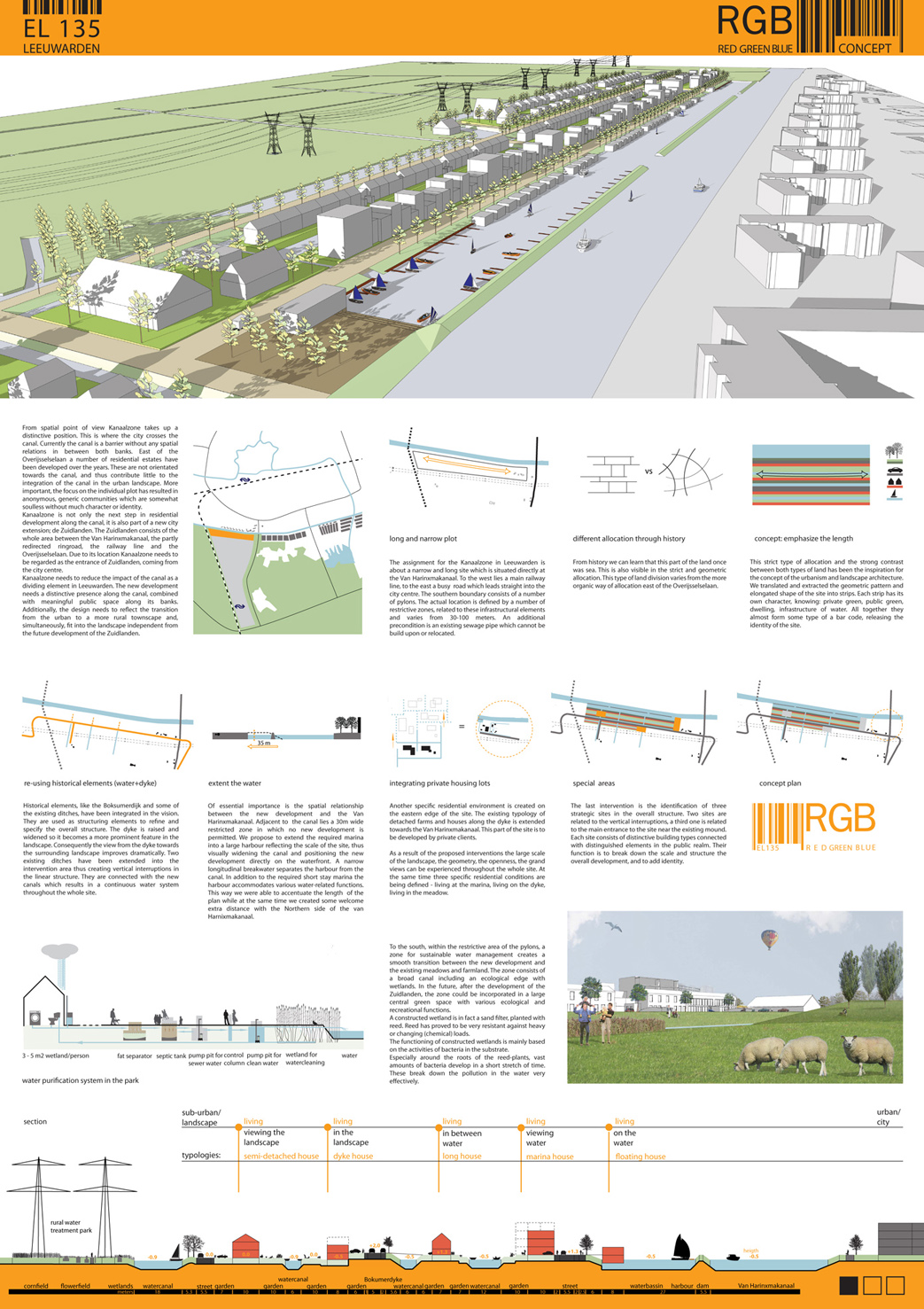
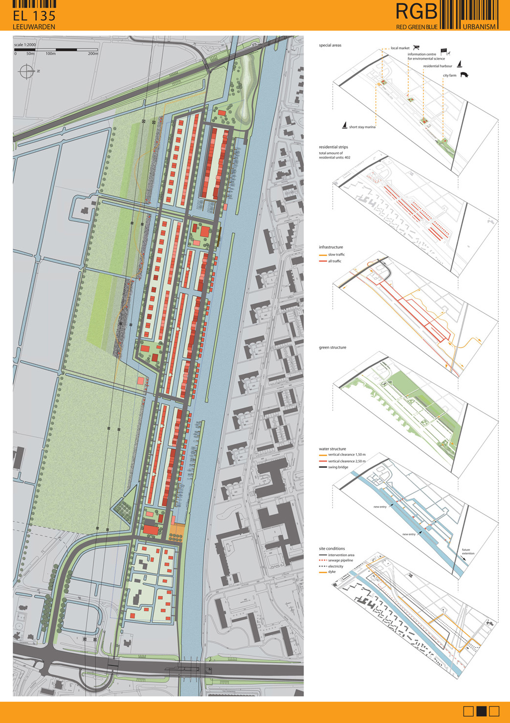
The objective for Kanaalzone in Leeuwarden is to create a contemporary version of the authentic Friese water settlement. In total approximately 400 to 500 residential units are required, mostly houses. The location is situated directly at the Van Harinxmakanaal. To the west lies a main railway line, to the east a busy road which leads straight into the city centre. The southern boundary consists of a number of pylons. The actual location is defined by a number of restrictive zones, related to these infrastructural elements. An additional precondition is an existing sewage pipe which cannot be build upon or relocated.
CONTEXT
The development area used to be sea. This is still recognizable in the openness of the landscape, the large scale, the current structure. There is hardly any development apart from a few farms. Also the Boksumerdyk is a relic from those days, going back to the 12th century. East of the Overijsselselaan the landscape changes dramatically. Here one encounters a small scale mosaic structure with some old mounds and farms. The original marshes are still clearly recognizable.
From spatial point of view Kanaalzone takes up a distinctive position. This is where the city crosses the canal. Currently the canal is a barrier without any spatial relations in between both banks. East of the Overijsselselaan a number of residential estates have been developed over the years. These are not orientated towards the canal, and thus contribute little to the integration of the canal in the urban landscape. More important, the focus on the individual plot has resulted in anonymous, generic communities which are somewhat soulless without much character or identity.
Kanaalzone is not only the next step in residential development along the canal, it is also part of a new city extension; de Zuidlanden. The Zuidlanden consists of the whole area between the Van Harinxmakanaal, the partly redirected ringroad, the railway line and the Overijsselselaan. Due to its location Kanaalzone needs to be regarded as the entrance of Zuidlanden, coming from the city centre.
PRECONDITIONS
Taking the context into consideration a number of preconditions can be established. Kanaalzone needs to reduce the impact of the canal as a dividing element in Leeuwarden. This relates both to the build environment and the public space. The new development needs a distinctive presence along the canal, with its own identity and a meaningful public space along its banks. Additionally, the design needs to reflect the transition from the urban to a more rural townscape and, simultaneously, fit into the landscape in a convincing way independent from the future development of the Zuidlanden.
The restrictive zones need to be carefully integrated in the design in an obvious, convincing manner. They should add value to the site and the context, without looking as ‘restrictive zones’. Not another soulless lineair park without meaning or purpose.
The required density and residential typology suggests a celebration of the individual life style; so no need for a surplus of public space. The amount of public space therefore can be minimized, and needs to be concentrated, if possible activated by specific uses. Street sections can be functional and compact. By allocating the developable land to the individual plot optimal conditions are created for both the residential environment and the public space.
BARCODE
The elongated shape of the site is further divided into three linear zones by the existing dyke, the sewage pipe and the pylons. To emphasize the specific shape the zones are interpreted as a collection of strips, each strip representing a specific land use; housing, private green, water, infrastructure and public green. The result is a bar code which expresses the site’s main characteristics and uses these characteristics to create a new spatial structure. Through a number of interventions the abstract bar code has been translated into a coherent vision for the site.
EXISTING LANDSCAPE FEATURES
Historical elements, like the Boksumerdijk and some of the existing ditches, have been integrated in the vision. They are used as structuring elements to refine and specify the overall structure. The dyke is raised and widened so it becomes a more prominent feature in the landscape. Consequently the view from the dyke towards the surrounding landscape improves dramatically. Two existing ditches have been extended into the intervention area thus creating vertical interruptions in the linear structure. They are connected with the new canals which results in a continuous water system throughout the whole site.
HARBOUR
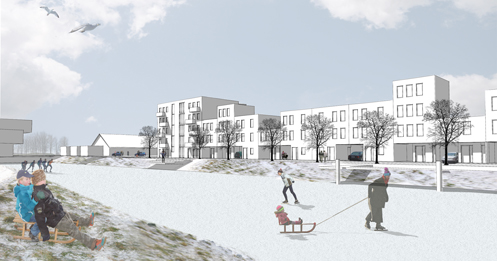
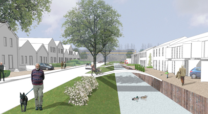
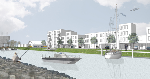
Of essential importance is the spatial relationship between the new development and the Van Harinxmakanaal. Adjacent to the canal lies a 30m. wide restricted zone in which no new development is permitted. We propose to extend the required marina into a large harbour reflecting the scale of the site, thus visually widening the canal and positioning the new development directly on the waterfront. A narrow longitudinal breakwater separates the harbour from the canal. In addition to the required short stay marina the harbour accommodates various water-related functions, including mooring facilities for the residents of Kanaalzone, house boats, jetties for recreational use etc. On the eastern end a series of steps connects the water with a main public space.
GREEN EDGE
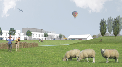
To the south, within the restrictive area of the pylons, a zone for sustainable water management creates a smooth transition between the new development and the existing meadows and farmland. The zone consists of a broad canal including an ecological edge with wetlands. Initially, this zone continues along the railway line towards the Van Harinxmakanaal. In the future, after the development of the Zuidlanden, the zone could be incorporated in a large central green space with various ecological and recreational functions.
FOCAL POINTS
The last intervention is the identification of three strategic sites in the overall structure. Two sites are related to the vertical interruptions, a third one is related to the main entrance to the site near the existing mound. Each site consists of distinctive building types connected with distinguished elements in the public realm. Their function is to break down the scale and structure the overall development, and to add identity. Commercial uses and community facilities are concentrated on or near these plots thus creating focal points for activities. The distinctive building types are contemporary interpretations of the traditional Friese farm.
RESIDENTIAL CONDITIONS
As a result of the proposed interventions the large scale of the landscape, the geometry, the openness, the grand views can be experienced throughout the whole site. At the same time three specific residential conditions are being defined – living at the marina, living on the dyke, living in the meadow. All residential units are orientated towards the public realm and have a back garden directly on the water. The various conditions are linked with density. From north to south the density decreases, reflecting the transition from an urban to a more rural environment. The housing typology changes from attached, relatively narrow, town houses to semi-detached houses near the meadow.
Another specific residential environment is created on the eastern edge of the site. The existing typology of detached farms and houses along the dyke is extended towards the Van Harinxmakanaal. This part of the site is to be developed by private clients.
ARCHITECTURE
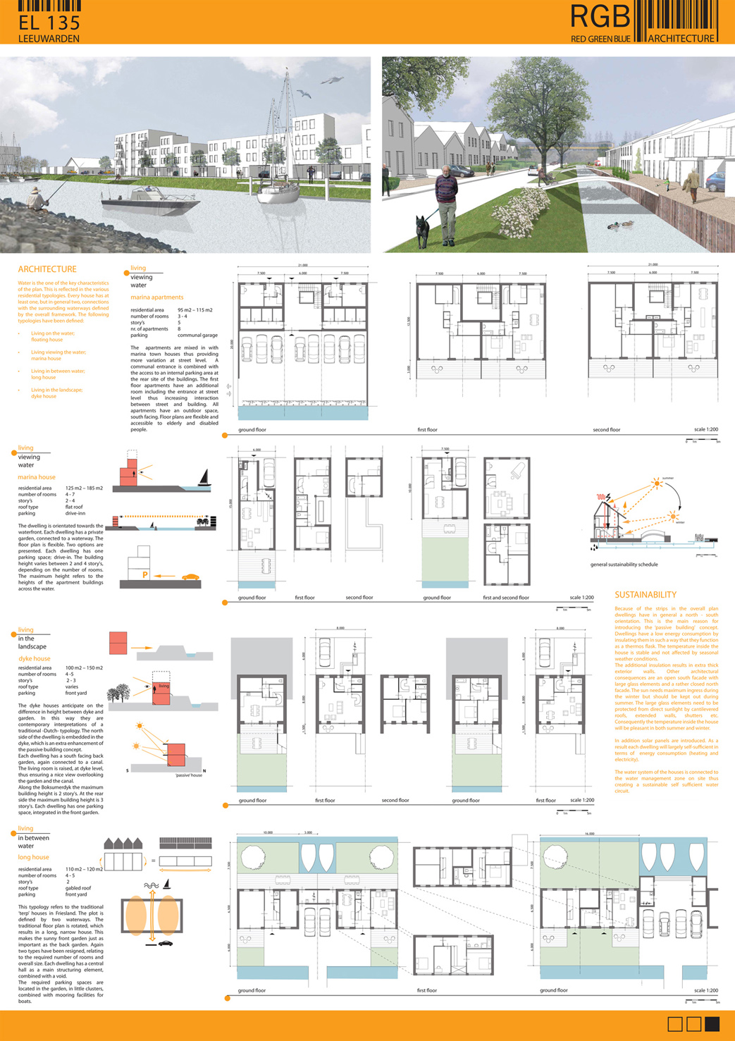
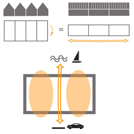
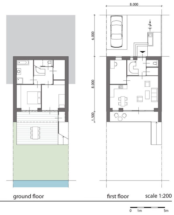
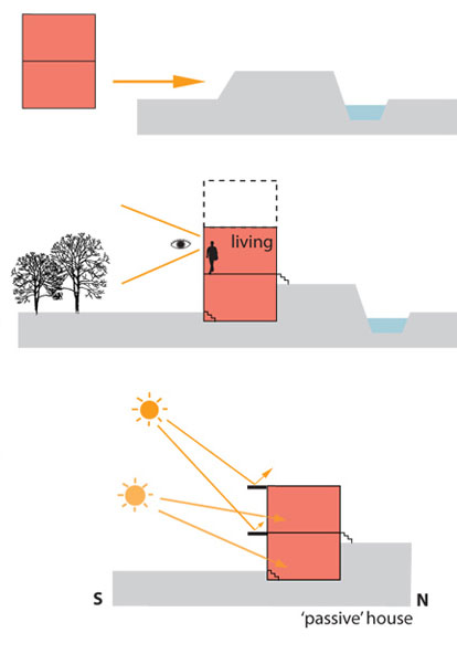
Water is the one of the key characteristics of the plan. This is reflected in the various residential typologies. Every house has at least one, but in general two, connections with the surrounding waterways defined by the overall framework. The following typologies have been defined:
• Living on the water = floating house
• Living viewing the water = marina house
• Living in between water = long house
• Living in the landscape = dyke house

